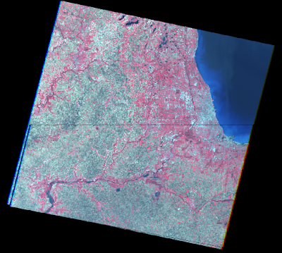
The goal of this lab was to be introduced to geometric correction, an important preprocessing exercise. Skills were developed in the two major types of geometric correction often performed on satellite images: spatial and intensity interpolation. These are normally part of the preprocessing activities used prior to the extraction of biophysical and socioeconomic information from satellite images. Figure 1 shows
Methods:
Part 1: Image-to-map rectification
In this part, an image of the city of Chicago was spatially and intensity interpolated using a map as a reference. Only a first order was used in this interpolation, with a 4 GCP's used. Nearest neighbor was used in resampling. Figure 1 shows the GCP's on both the reference map and the original image. Figure 2 displays the new output image compared with the original image using the swipe tool.
Part 2: Image-to-image rectification
In this part, an image was spatially and intensity interpolated using an image as a reference. This part used a third ordered interpolation and 12 GCP's in order to rectify the images quite closely. Bilinear interpolation was used in resampling for this part, which created a smoother image compared to part 1. Figure 3 shows the GCP's on both the reference image and the original image. Figure 4 shows the new image compared with the original image using the swipe tool.
Results:
 |
| Figure 1 |
 |
| Figure 2 |
 |
| Figure 3 |
 |
| Figure 4 |
Sources:
Satellite images are from Earth Resources Observation and Science Center, United States Geological Survey. Digital raster graphic (DRG) is from Illinois Geospatial Data Clearing House.
No comments:
Post a Comment